
Story has been updated to include the Navy's official response.
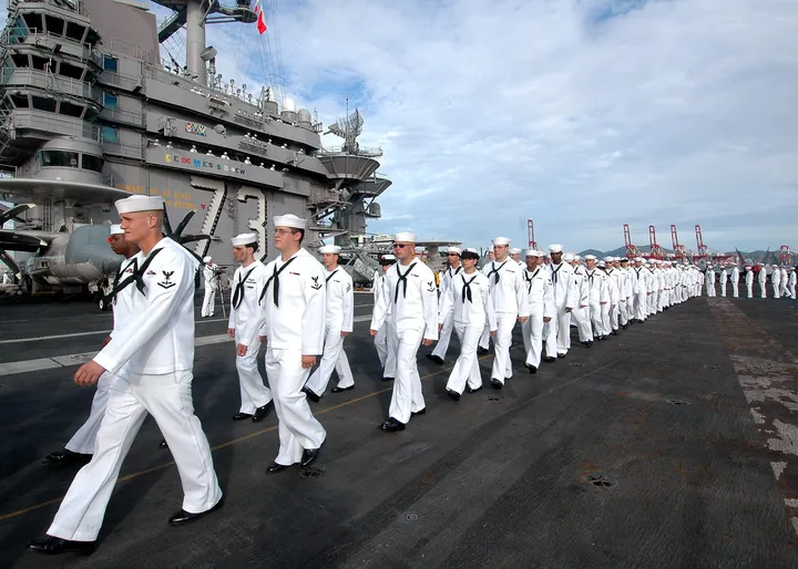
San Pedro, California residents are seeing red over the redlined maps the Navy handed out to thousands of seamen who disembarked at the Port of Los Angeles this week.
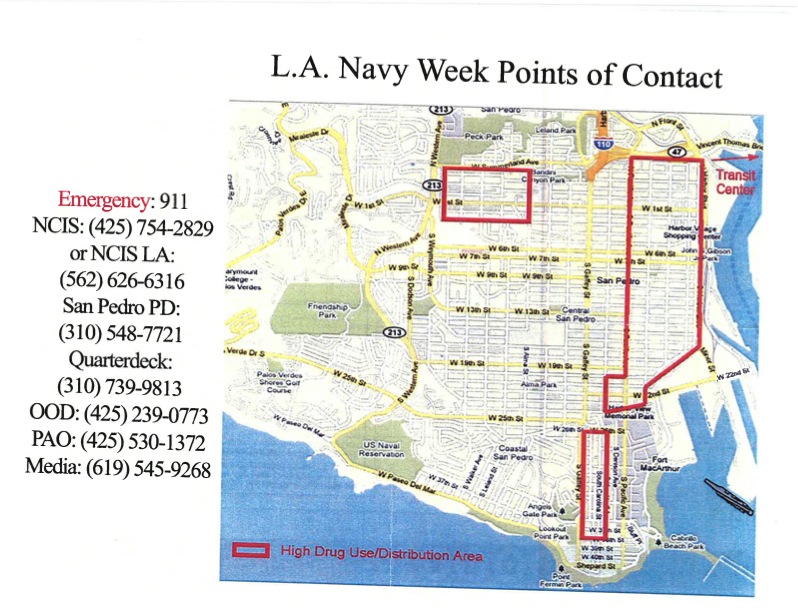
The maps, meant to be a guide to the areas surrounding the port, warn sailors that the majority of downtown San Pedro is unsafe. The area is bordered in red and labeled a "high drug use/distribution area," reports the Daily Breeze.
Restaurateur Andrew Silber of The Whale & Ale, who was offering discounts for all personel and crew from the ships, was the first San Pedro resident to discover the map. Silber told The Huffington Post that "a member of the the crew from the U.S.S. Abraham Lincoln" showed him the map, unprompted. Silber was shocked. "We had no idea such a thing existed," he said. A photo of the map was taken with Silber's iPad, and he promptly uploaded the image to various San Pedro facebook pages.
Photo of map provided courtesy of the San Pedro Chamber of Commerce.
Cameilla Townsend, executive director of the San Pedro Chamber of Commerce, had been liaising with Navy officials for months to prepare for LA's first ever Navy Week. She was one of the official greeters when the ship docked last Monday and remembers personally greeting the Admiral. On behalf of the chamber of commerce, Townsend told The Huffington Post, "we're extremely surprised because we've been working on preparations for Navy Week for a long time." Townsend listed off the business directories and brochures that were aboard the USS Lincoln and added that many of Downtown San Pedro's restaurants and shops were offering big discounts for members of the Navy and the ship crew in honor of their visit.
After Townsend confirmed that the Navy officials she had been working with had no idea about the maps, she determined that the Naval Criminal Investigative Service (NCIS) were the ones who created and distributed the maps.
Phillip Sanfield, a spokesperson for the Port of Los Angeles, said, "we're not sure what the source [of their information] was, but downtown San Pedro is safe." He emphasized that the port is in the midst of its busiest summer yet, and a recent event that saw 20,000 was completely without incident. Sanfield also recalled that a weekly Summer concert series on Thursday nights was also without incident.
When he and representatives from other San Pedro booster groups confronted the Navy with the map, Navy leaders agreed to not distribute the maps to the two other ships, USS Princeton and USS Chafee, that are docking today.
Paul O'Donnell of the Navy sent an official statement to The Huffington Post on the issue confirming that the NCIS did hand out redlined maps to personnel as they entered the city. The highlighted areas weren't, however, off-limits. The statement, in part:
The small pockets of San Pedro were included in a list of areas where extra caution should be used while on liberty. The sailors were simply urged to use extra caution in those areas, which according to crime statistics have had a higher incidence of criminal activity. The areas on the map were not chosen arbitrarily. No areas were considered off limits... We will continue to clarify to incoming Navy personnel that there are no off limits areas in the metro Los Angeles area, but like in any other large metropolitan city, extra caution should be used in certain areas, especially after dark.
The Daily Breeze notes that this isn't the first time San Pedro has been left behind regarding tourist opportunities. When a cruise ship had to make an unexpected stop in 2009, vacationers were driven off to Long Beach instead of encouraged to explore the surrounding port areas.