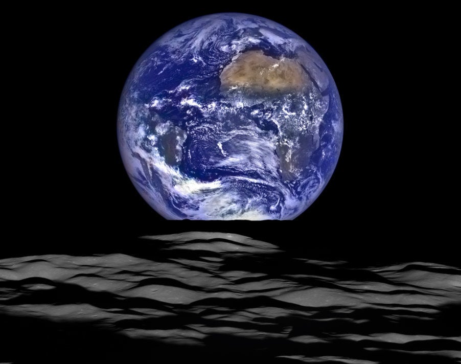
The First Pictures From NOAA's Newest Weather Satellite Are Incredible

"These images come from the most sophisticated technology ever flown in space to predict severe weather on Earth."
LOADINGERROR LOADING

NASA and the National Oceanic and Atmospheric Administration on Monday released the first photos taken by a new weather satellite, launched last November, that promises to result in more accurate and timely forecasts.

The GOES-16 satellite (previously called GOES-R) is the first of four weather satellites that will provide images of the entire Earth from a geostationary orbit roughly 22,300 miles above the equator. The second satellite is expected to launch sometime in the spring of 2018.

GOES stands for “Geostationary Operational Environmental Satellite,” the first of which launched in 1966.

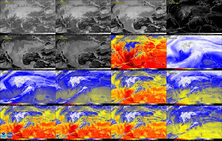
Compared to the previous generation of weather satellites, the imaging instrument aboard GOES-16, known as the Advanced Baseline Imager, is five times faster and has four times the resolution. It can also capture images in 16 different wavelengths, a big step up from the five available on the previous system.

Being able to see the Earth at those specific wavelengths is important, NASA explained, as it enables scientists to differentiate various atmospheric components like clouds, water vapor, smoke, ice and volcanic ash.

The satellite also features a first-of-its-kind lightning mapper that will track both cloud-to-cloud and cloud-to-ground lightning strikes, which can be an indicator of intensifying storms, NASA said.

“This is a quantum leap,” Sandra Cauffman, deputy director of Earth Sciences at NASA, said at a press conference when GOES-16 launched last November. “It will truly revolutionize weather forecasting.”
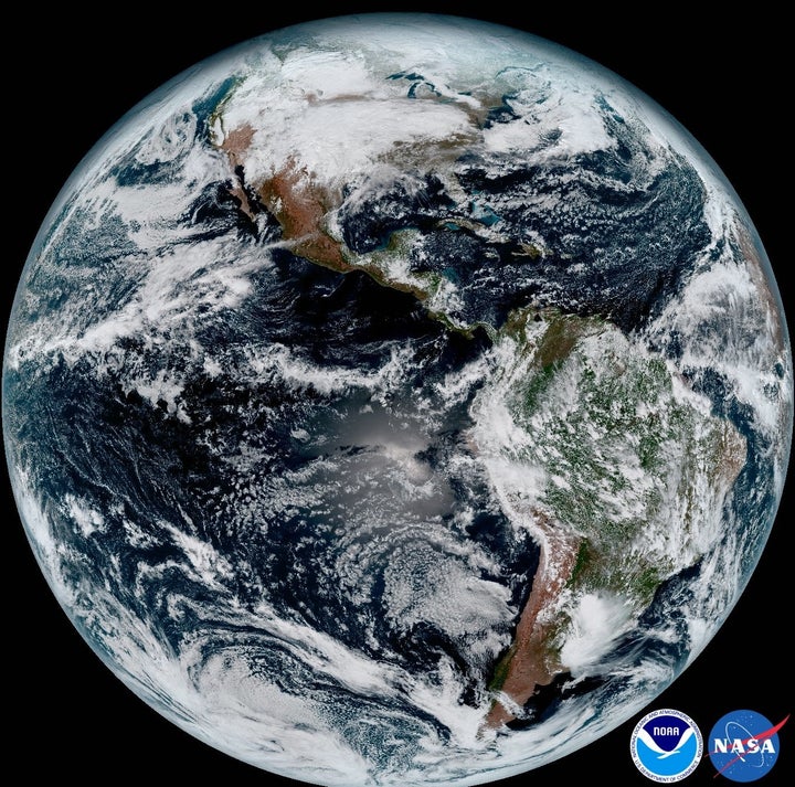
This composite image was taken on Jan. 15. The satellite can capture an image of the Earth stretching from West Africa (far right) all the way to Guam in the Western Pacific (far left).
NASA/NOAA

“These images come from the most sophisticated technology ever flown in space to predict severe weather on Earth,” Stephen Volz, the director of NOAA’s Satellite and Information Service, said in a release Monday. “The fantastically rich images provide us with our first glimpse of the impact GOES-16 will have on developing life-saving forecasts.”

Check out more images below:
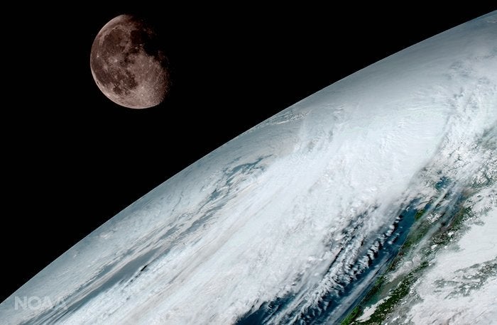
The moon as seen from geostationary orbit 22,300 miles above the equator on Jan. 15. GOES-16 uses the moon for calibration, according to the NOAA.
NOAA / NASA
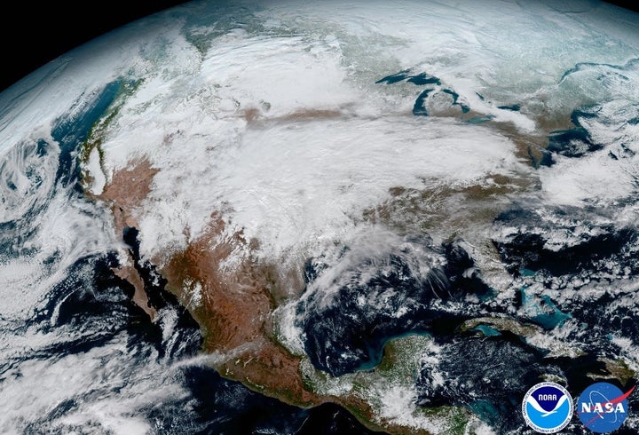
A massive storm system moves across the United States in this image captured aboard GOES-16 on Jan. 15.
NASA / NOAA
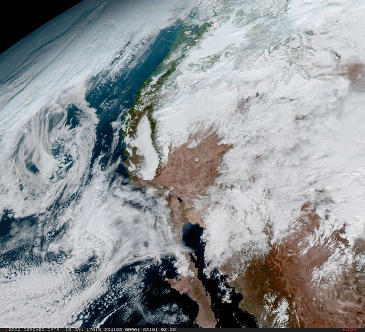
GOES-16 captured this image of the west coast of the United States and the Baja Peninsula in Mexico on Jan. 15.
NASA/NOAA
A storm system seen via each of the 16 different wavelengths visible to the ABI. Per NOAA, this includes (from left to right, starting at the top) two in the visible spectrum, four near-infrared and 10 infrared channels.
NASA/NOAA
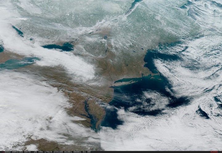
Severe weather passes through the Northeast and central U.S. on Jan. 15 in this image captured from GOES-16.
NASA/NOAA

Before You Go

The Home Planet

Dazzling Satellite Photos Show Earth From Above

Popular in the Community

Close

What's Hot