
When I was a river guide on the Colorado River through the Grand Canyon I found myself with a couple of weeks off between assignments. I had read Tom Brokaw’s account of his wild trip down the Middle Fork of the Salmon in a magazine called West and was drawn to feral nature of the watercourse. It was already a fabled whitewater run, and celebrity boaters such as Robert Kennedy, Arthur Godfrey, George Romney and Jimmy Carter added luster to the legends. It was, by many estimations, the finest river run in America, and I had to give it a go.
I had the time off, but two minor problems remained: I didn’t have a car, and I didn’t have a raft. I recruited fellow Colorado guide Breck O’Neill, and together we hitched to his mom’s house in San Jose, where we convinced her to loan us her station wagon. We also picked up Breck’s high school friends Dave Plapp and Mary Pollino, who, while not river runners, wanted to share in the adventure. Together we headed for central Idaho, the long way—in that we first went to Vernal, Utah (500 miles out of our way) and the warehouse of my employer, Hatch River Expeditions.
I cornered co-owner Don Hatch and asked if we could borrow a raft for our journey. Everyone knew that the Middle Fork was Don’s favorite; besides, his father, who had recently died, had made a pioneering run down the river in 1936. So, I thought we would be tugging at his heart strings with our appeal. Nonetheless, Don was not enthusiastic about loaning out one of the tools of his trade, especially to a young buck who the season before had ripped the bottom out of a company raft on the Colorado. I persisted, likening our quest to a holy mission, and at last he consented, warning that we had to return the raft in exactly the same condition or we would have to pay for full replacement. He then pulled a black blob from the back of the warehouse, dusted off a layer of talcum powder, and presented us with our means of conveyance.
“She’s one of my best boats. Take real good care of her,” Don curled his lips.
I recognized that smile. It was on the face of the dealer who sold me a 1963 VW bug that blew up a week after I bought it. Still, we graciously accepted Don’t offer, strapped the frame and oars on top of the station wagon, pushed the blob in the back, and waved goodbye.
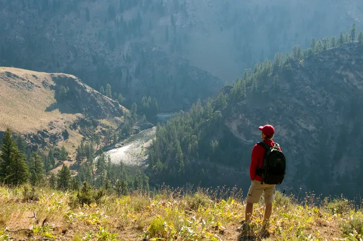
The drive north into the massive western edge of the Rocky Mountains was humbling. To an easterner accustomed to the long, rounded ridges of the Appalachians, these mountains seemed desolate and impenetrable. No wonder the Middle Fork had been spared dams, highways and other developments, though not for lack of trying.
In 1805 William Clark, of the Lewis and Clark Expedition, attempted to explore the Salmon as a possible water route to the Columbia River, but he turned back when it became clear the rapids were impassable by boat and the canyon walls were too steep for horses and men. A century later, with the advent of specialized boats, access by water became a reality, but the rugged terrain still kept all but the most determined, and intrepid, at bay.
The following twilight we trundled into the Stanley Basin and at dusk arrived in Stanley, Idaho. We quickly found the hot spot in town—the thermal springs—and immediately slipped in for a soak. The night was so crisp the stars seemed to crackle and in the torpid curls of steam I could see the eddies and waves of the river we were about to encounter.
Designated by Congress in 1968 as part of the National Wild and Scenic River system, the Middle Fork of the Salmon is the last great American river remaining, throughout its course, unfettered by dams or hydro-projects of any kind. It begins life at the confluence of Bear Valley and Marsh creeks 20 miles northwest of the hot springs we were enjoying. The source was discovered in 1863 by a mining party led by Captain John Stanley, for whom the closest town is named. Running in the shadows of the two-mile-high peaks of the Sawtooth Range, the river plunges 1600 feet in its 104-mile race to a union with the Main Salmon. Enroute it cascades through the Frank Church River of No Return Wilderness, named in 1984 after the late Idaho senator cited it as one of America’s “premiere wilderness champions.”
At dawn the next morning we bounced down to the Dagger Falls put-in and, for the first time, unrolled our borrowed boat—a thin-skinned cotton neoprene survival raft shaped like an Easter basket. The raft was designed to carry a dozen survivors on the open sea with the sinking of the mother ship; it was not meant for sharp rocks or downriver negotiation. Yet, in a pinch, penny-pinching outfitters often used these boats, which could be purchased as government surplus, to carry clients on lenient runs. Our version looked as it if had already run the Styx—it was covered with patches and caramel streaks of hardened Barge glue.
“If this boat doesn’t make it, we’re all responsible for paying for a replacement,” I reminded our little group as we all stared at the wad of rubber at our feet, a wad that looked more like a dead seal than a raft.
Breck and Mary nodded in agreement. They were anxious to get on the river, whatever the costs or consequences. Dave took a couple minutes before replying; he’d never been rafting and was questioning the wisdom of this little excursion.
But then he hesitantly said, “Okay, I’m in,” and we prepared to cast our fates to the river.
After re-patching a half-dozen pinhole leaks, tying down the orange wooden frame, attaching the nine-foot white ash oars, we shoved off into the fast, cold currents of the Middle Fork and held on for a ride down a bolt of liquid lightning.
Almost immediately, before I had managed more than a dozen strokes, we whizzed by the first tributary on the left, Sulphur Creek. We launched at an elevation of 5,700 feet and were dropping fast, some 42 feet per mile, on a water slide with eddies, down a bowling alley with no gutters. I was at the oars, pulling frantically against the current to slow us down, but we were in the river’s grip and were being pulled toward our first test: the coarse fabric of Velvet Falls.

The face of the ranger at the Challis National Forest stations had creased to a wide smile when he told us of Velvet Falls, five miles below the put-in, the first class IV rapids down river. He said the run on the wrong side—the right—dropped sheer and spun a web of whitewater chaos. The trick to running Velvet was to spot the large marker rock on the left while approaching and then position for a left-side plunge.
The advice seemed easy to heed, only now in the midst of the millrace, I couldn’t tell how fast we were going or how far we’d traveled.
“Think we’ve gone three miles yet?” I called out.
“I don’t think so,” Dave answered as we barreled down the right bank.
Seconds later, Breck screamed, “There’s the marker rock. Pull over!”
No way could I make the left shore, so I strained my back, pumped the oars like pistons, and managed to scrape the eastern bank. Mary jumped out with the stern line and tried to hold us. But the boat wouldn’t brake, and she was dragged along the lichen-covered rocks, desperately grasping the end of the rope.
“It’s burning,” Mary’s face wrenched in pain.
“Don’t let go,” Dave shouted back, but it was a useless call.
The rope yanked like a snapping winch cable from her raw hands, and raft shot back into the current, heading for the hairy lip of the terrible right-hand side of Velvet Falls.
The three of us braced for the drop, and down we fell. The raft struck the bottom and started to twist sideways, as though crouching for a capsize. I took one concentrated, correcting stroke with the left oar, and tang, the oarlock snapped, sending the oar into orbit, and me into the duffle pile. The raft kissed the edge of capsizing, then plopped back down and spun toward the right shore, where Breck was able to secure the boat to a tree.
The damage was minimal; the loop of the oarlock was gone, probably two dollars’ worth of metal. But, it was a critical piece, and we had no replacement. So, we found a sturdy piece of Engelmann spruce branch. I whittled it down to the thoe-pin size with my Swiss army knife, and then lashed the oar to the makeshift pin. The process took an hour, about the time it took Mary to thrash through the overgrowth to reach us. The jury-rigged oarpin setup didn’t inspire confidence, especially since we had 34 rated rapids to go, but it was all we had. So, with equanimity punctured, we reloaded and headed downstream.
The going was easier now, although rowing with an oarlock on one side, and a crude thoe-pin lashed to the oar on the other, made for less-than-smooth navigation. It was like running on crutches.
The next day we shot through Artillery and Cannon Creek rapids on target, not even a powder burn. We also passed tributaries named Mortar, Springfield, Winchester, Remington, Colt and Popgun. The hot sun broke along the black raft, but the water was refreshingly cold when it splashed my skin, and it was clearer than any gin I had ever encountered. In the calm stretches I could lean over the raft and watch the colored, cobbled riverbed glide beneath me as though we were riding on glass. Sometimes the river was utterly still, and the only movement the lazy turning of my own thoughts.

As though detonated, we blasted through the barrel-tight S-turn of Pistol Creek, and then purled into Indian Creek, a level strip of bank where small planes bring in clients and gear during the later weeks of summer when the water is too low to launch upstream at Dagger Falls.
Though the river was fattening with each feeder stream, it didn’t slow down, and for the next 30 miles we were treated to a full course of Class II and Class III rapids, all in a setting that would rate VII on the I-VI scale. Peaks surrounded us on all sides, the Salmon River Mountains to the west, the Bighorn Crags to the east, some craggy with bald rock faces, others blanketed with quilts of conifers and golden grasses. The canyon we were traversing was carved from the Idaho Batholith, a 100- by 200-mile mass of granite that once lay under volcanos long since eroded away, and dated at over 100 million years old.
On the third day, we came to Tappan Falls. Actually, a series of four closely spaced drops, Tappan is rocky even in high water. The lashing holding the makeshift oarlock had loosened so that the blade of the oar bounced though the water as though rubber. I managed to steer the raft down the roiling right side of the river, but in the second drop the boat grated over a kernel of exposed granite, and the sound of the raft ripping drowned the rapids. In a flash, Dave and Mary and the duffel pile were sucked out of sight, as though dropped through a trapdoor. I looked down between my legs and saw the river. The raft’s bottom was gone, torn into two segments that flapped in the water like the wings of a stingray.
Frantically we wrestled the remains of our raft to shore, finally connecting at a small eddy below the last of the Tappan drops. Dave and Mary has splashed to shore a couple of hundred yards downstream and had made their way back up to our anchorage as Breck and I pulled the blob up onto a level spit of shore that was overrun with sharp grass, thorn bushes, and ninebark. A bow-to-stern rip bisected the floor, a rip that would take at least half a day to repair. So, we gathered what had been retrieved of our gear, spread it out like pieces of a jigsaw puzzle to dry, and I set to work sewing the floor with a huge hooked needle and a spool of 30-pound-test nylon fishing line.
Clouds of mosquitoes rolled around our heads, and I spent more time scratching and slapping than patching. With the last rays of sunlight, I finished, pleased with my handiwork. I stepped onto one of the raft’s tubes to raise my hand in triumph, and an explosion threw me to the ground. My weight had burst the tube. Half the boat was suddenly deflated, looking like a collapsed lung. While most inflatable whitewater rafts have at least four independent chambers, and some have six, our little craft had just two. I looked closely; the fabric of the tube was rotten. The whole boat was cursed. Our expedition was coming apart at the seams. And we were halfway down the river, with the biggest rapids yet to come.
I suffered through a miserable night in my wet goose down sleeping bag, listening to the river making obscene swallowing noises by our bivouac. With the first frosty light, I was up and patching. The repairs were finished by breakfast, but it took another half day for the glue to set. Dave, looking wan and feeble, had spent much of the night bent behind a tree. He was afflicted with giardiasis, picked up, we suspected from the untreated Middle Fork water we’d all shared.
By noon we were on the water again. We had only inflated the raft 80 percent to ease the pressure of its flimsy skin. We made it through Aparejo and then Haystack, where a boater had drowned the year before. At the confluence of Big Creek, we entered Impassable Canyon, where the worst of the Middle Fork rapids tore holes in the river. The gorge was named by U.S. First Cavalry Captain Reuben S. Bernard in 1879 when he led an ill-conceived expedition to capture the Sheepeater Indians in the area, and was turned back by the terrain. Our expedition seemed equally ill-conceived. The river was now huge, the size of the Colorado, and a cold wind blew upstream as though from a tomb. We ran Porcupine Rapids with no new difficulties, then we careened through the center of Redside, a major rapid named for its colorful cutthroat trout.

Suddenly the floor I had so meticulously mended split open again, and once more the river yawned beneath me. I was out of control. My strokes meant nothing. And we were now in the angled waves of Weber Falls.
I struggled with the oars, threw my weight to the high side as we plunged through wave after giant wave, and saw three companions doing the same, faces white as the water. We dropped into a hole sideways, the frame cracked, and my tube patch blew out. Somehow, we managed to hobble into the calm water below right-side-up, with everyone miraculously still in what was left of the boat.
Again, we pulled over for repairs, but I had used all the Barge cement glue last round. Dave was slapping his sides, and his speech was slurred—the beginnings of hypothermia. We talked of hiking out, but the 4,000-foot-high walls were too steep. The gorge was named Impassable for a reason. With no interrupting edge of riverbank, the sheer flat rock face of dark gray granite formed a crypt-like chamber that revealed no end or exit. The map showed just ten river miles to go, and about as many rapids. We decided to go for it.
First, we re-laid the patch that had popped off. Without new glue, it barely stuck, so Mary agreed to sit on the patch, which reduced the situation to a slow leak. Then, we fastened the nozzle of the foot pump to the valve of the leaking tube with duct tape. Breck sat on the thwart with the foot pump in his lap and continued to pump with his hands as I rowed.
We limped through Cliffside, then with five miles left we rolled into Rubber. The waves were huge, as big as a Pacific Tsunami, and we rode them as though surfers on the North Shore. In the last wave, the raft pitched up a crest, stalled at the top, and bent both the bow and the stern on opposite sides of the wave, and again we heard a horrifying pop.
The other tube had split a seam, and half the raft immediately deflated. We all scrambled to a perch on the tube with the patch, and Breck continued to pump.
The frame hung limply, half in the water, completely useless. There was no way to row to shore. Dave threw me a terrified glance. All we could do was hang on. The blob with four passengers drooped through Hancock, Devil’s Tooth, House Rocks, and Jump Off Rapids, and then we were finished. Like shipwreck survivors hanging onto flotsam, we drifted into the confluence, the clear water of the Middle Fork disappearing into the gray water of the Main.
When I returned the shredded blob of a boat to Don Hatch, I complained it wasn’t all it was cracked up to be. Don insisted it had been in perfect condition before we trashed it, and held us to our end of the bargain—we had to pay for a replacement. I swallowed and asked how much, thinking he’d want a couple thousand or more.
“$50, and we’ll call it even,” he grinned that grin.
I peeled the bills and grinned back. The moment was incalculable; the trip priceless
